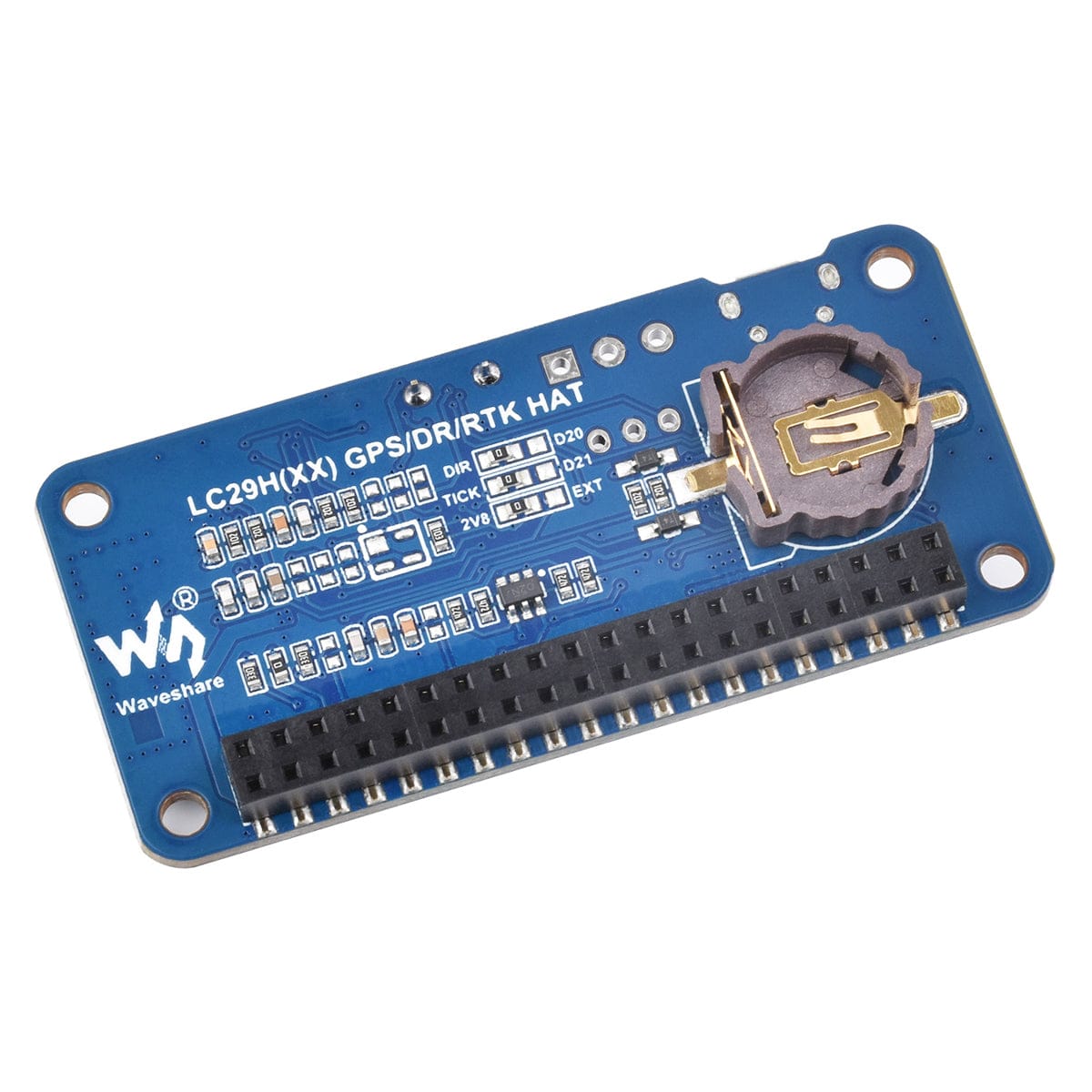
LC29H(AA) GPS HAT for Raspberry Pi
Price:
Sale price
£38.40
Stock:
Quantity:
Login / Signup
Cart
Your cart is empty
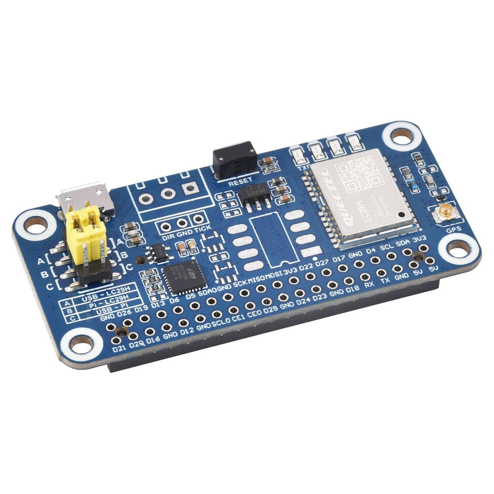
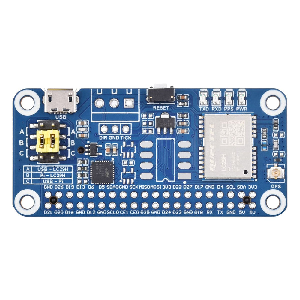
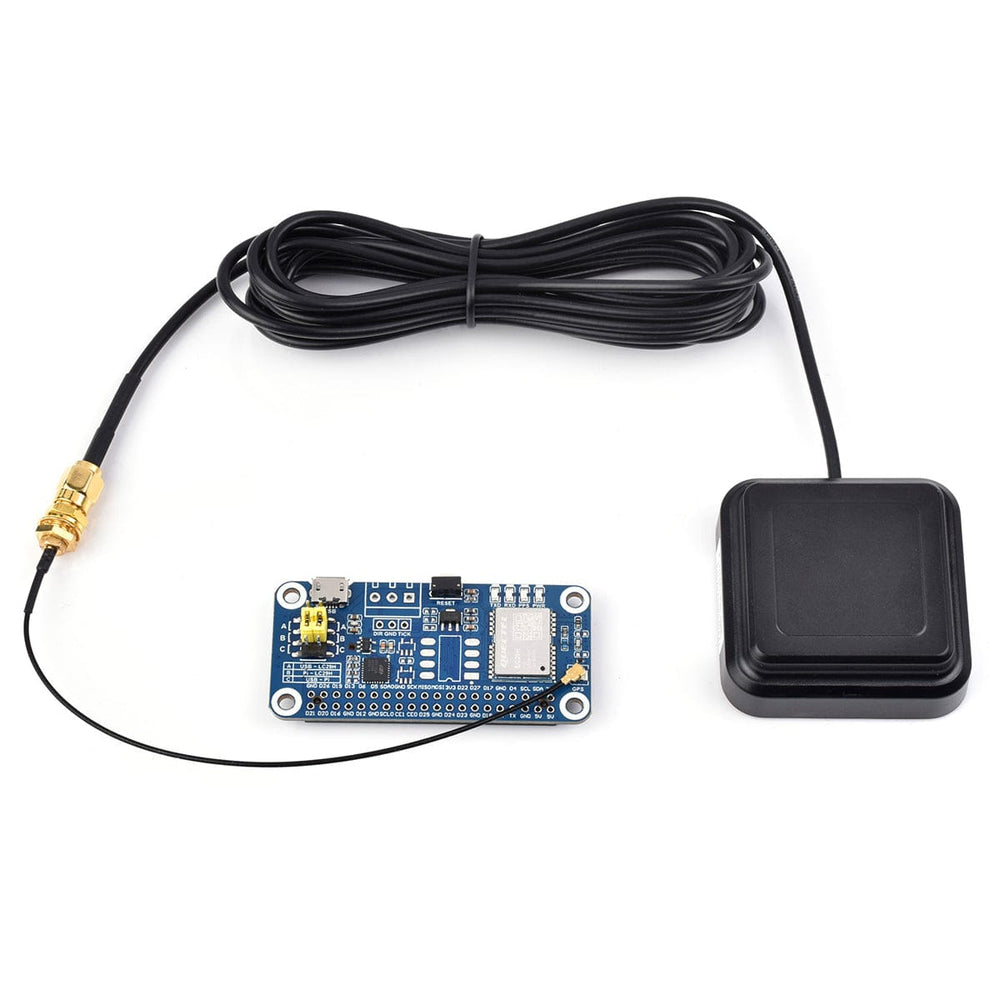
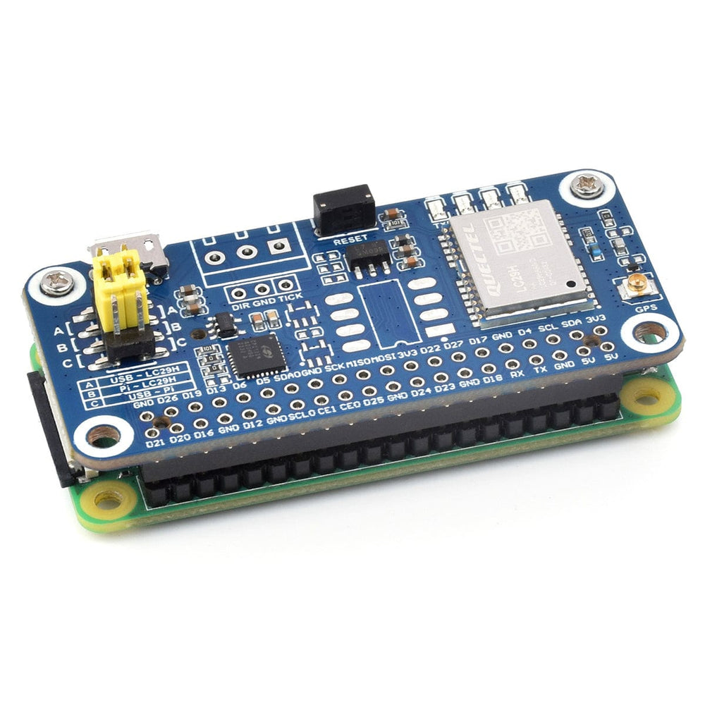


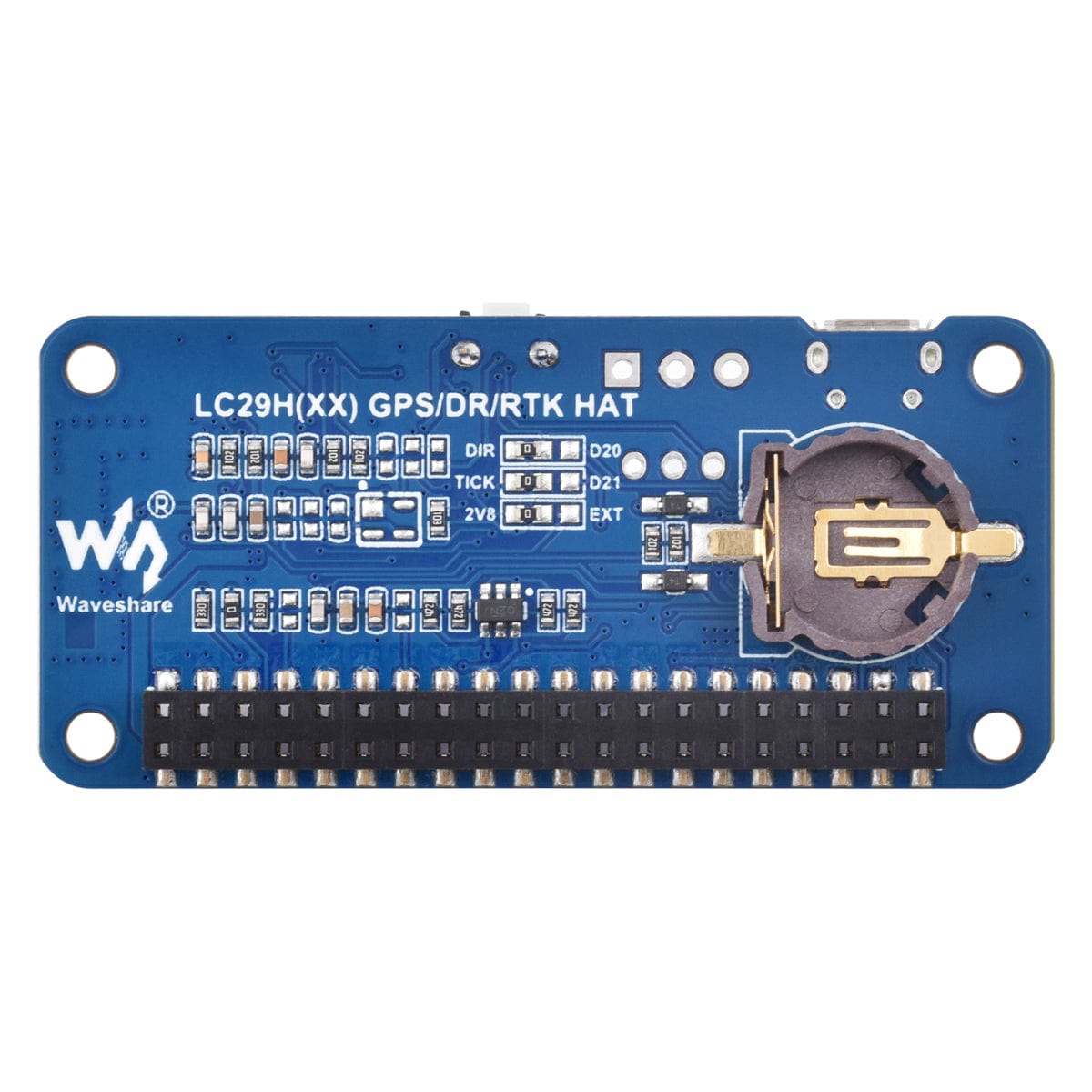
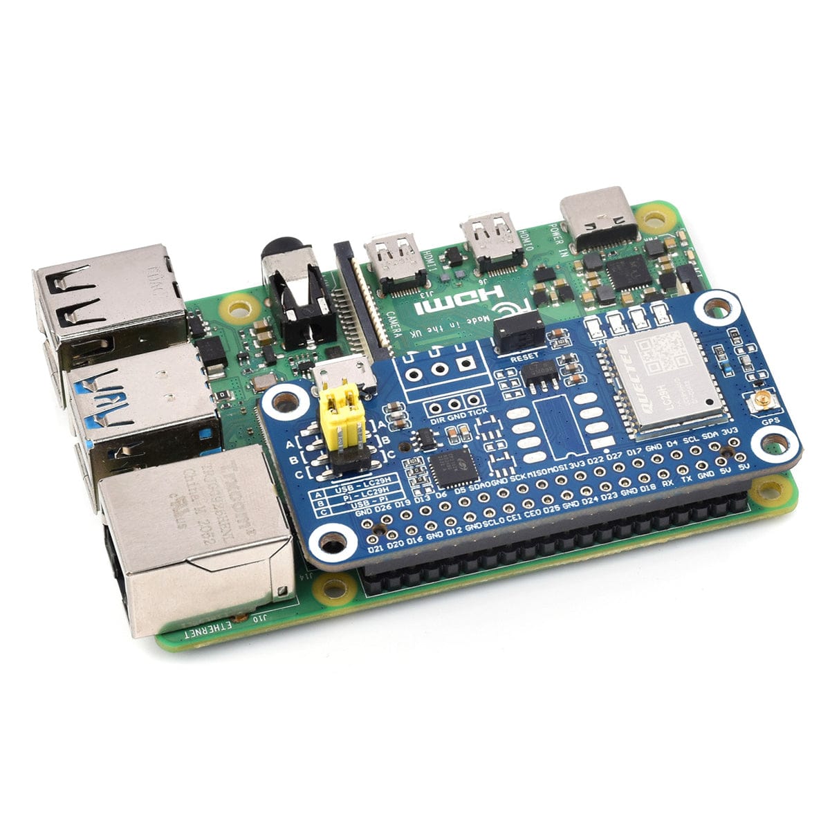
This LC29H(AA) GPS HAT has high signal multipath effects like urban canyons, thanks to its ability to track L1+L5 dual-frequency and multi-GNSS signals, significantly upgrading positioning accuracy. It features a built-in Low Noise Amplifier (LNA) and Surface Acoustic Wave (SAW) filter, providing high sensitivity and robust anti-interference capabilities.
It has dual-band positioning and Real-Time Kinematic (RTK) technology, catering to projects needing centimetre-level precision such as drones, smart agricultural machinery, and shared mobility solutions like two-wheelers. It's also good for real-time tracking systems.
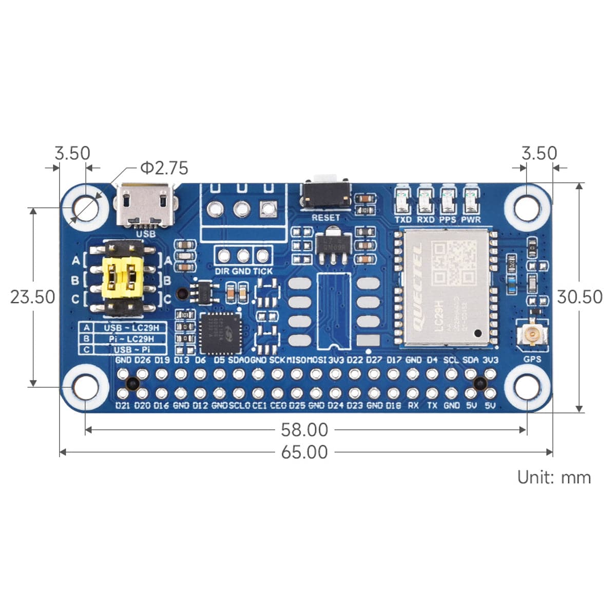
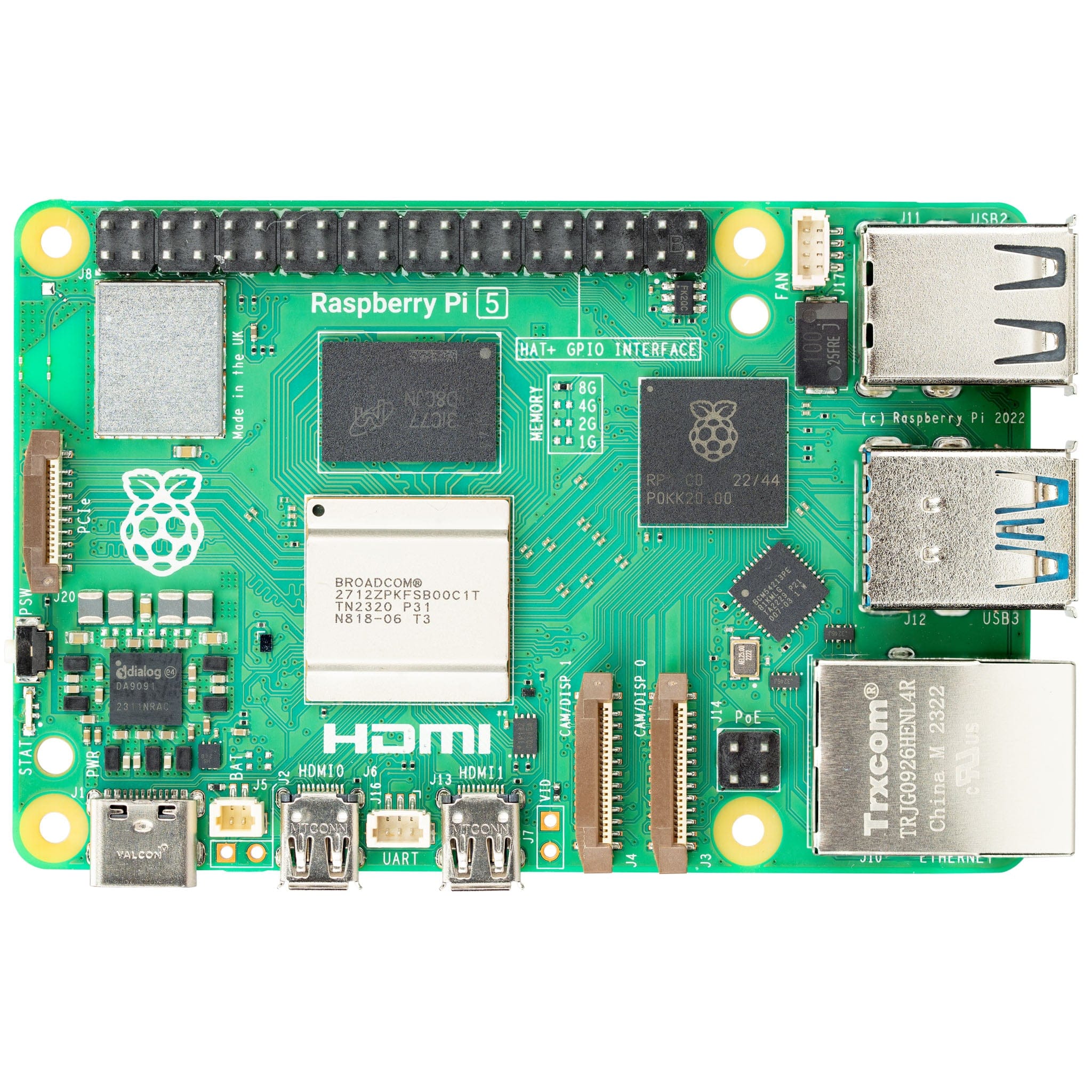
There is a standard Raspberry Pi 40-pin GPIO extension header, supporting Raspberry Pi series boards and the Jetson Nano. It also supports the simultaneous tracking of multiple satellite signals and systems (GPS, BDS, GLONASS, Galileo, and QZSS), all while maintaining low power consumption. It also includes support for various positioning augmentation systems like WAAS, EGNOS, MSAS, and GAGAN, which enhance service area performance. The EASY technology further allows for efficient positioning using stored ephemeris and almanac data when signals are unavailable, improving both the positioning accuracy and time to first fix.
We also have the
Note: Raspberry Pi boards are NOT included

| Frequency Band | GPS/QZSS: L1C/A, L5 |
| BDS: B1I, B2a | |
| Galileo: E1, E5a | |
| GLONASS: L1 | |
| Number of Concurrent GNSS | GPS/QZSS/ BDS/ Galileo/ GLONASS |
| SBAS (WAAS, EGNOS, MSAS, GAGAN) | Support |
| RTK Function | N/A |
| Positioning Accuracy | PVT - 1m CEP |
| RTK - N/A | |
| Navigation Update Rate | PVT - 1~10Hz |
| RTK - N/A | |
| RAW - 1Hz | |
| RTK Convergence Time | N/A |
| Time to First Fix (AGNSS Off) | Cold Starts - 26s |
| Hot Starts - 1s | |
| Aided Starts - 16s | |
| Time to First Fix (Easy On) | 2s |
| Time to First Fix (AGNSS ON) | Cold Starts - 5s |
| Hot Starts - 5s | |
| Aided Starts - 5s | |
| Sensitivity | Tracking and Navigating - 165dBm |
| Re-Acquisition -159dBm | |
| Cold Starts -147dBm | |
| Velocity Accuracy | 0.2m/s |
| PPS Accuracy | 20ns |
| Dynamic Performance | Acceleration (Max): 4g |
| Altitude (Max): 10000m | |
| Velocity (Max): 500m/s | |
| Communication Interface | UART(9600~3000000bps, 115200bps by default), I2C(Max 400KHz) |
| Protocol | NMEA 0183 V4.10, RTCM 3.x |
| Power Supply | 5V |
| OVERALL Current | <40mA@5V (Continue mode) |
| Operating Temperature | -40~85℃ |
| Dimensions | 65 x 30.5mm |


Your payment information is processed securely. We do not store credit card details nor have access to your credit card information.